|
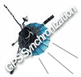
GPS Synchronization of Analog I/O Boards for SONAR
| GPS Synchronization of Analog I/O Boards for SONAR
|
New features give analog I/O boards the ability to synchronize via GPS
world-wide allowing for very predictable data sampling!
Low noise, 24-bit resolution, low phase distortion and multi-board
synchronization make Sigma Delta analog input boards ideal for
state-of-the-art sonar and noise monitoring applications.
The GPS Synchronization feature allows the boards to synchronize to an
external timing reference, the external sync input pins in the I/O connector
can be configured to accept a 1PPS GPS clock (LVDS or TTL).
General Standards Corporation is a leading supplier of a wide range of analog I/O boards for embedded applications on several form factors/busses,and for many operating systems.
|
Features include:
Up to 64 input channels per board;
Programmable Sampling rates to 50M SPS;
Auto-calibration;
Multi-board synchronization;
Sigma-Delta and Delta-Sigma Analog I/O;
Resolutions from 12 bits to 24 bits.
|
|
Applications include: Sonar, battery monitoring, voice digitizing, precision instrumentation, noise monitoring, and sona-buoys, etc.
[View Analog I/O Selection Table for General Standards]
[View 24-Bit Delta-Sigma or 16-Bit Sigma-Delta Analog I/O Selection Table]
Form factors supported include PMC, CCPMC, XMC, PCI, PCI-X, PCI-Express, cPCI, cPCI-X, VME, PC/104-Plus, and PC/104-Express.
Numerous software drivers are available for Windows, Labview, Linux, MathWorks, xPC, VxWorks, QNX, and Solaris. Drivers are also available for host boards from Spectrum Signal Processing and Mercury Computer Systems.
Other functions available include serial I/O and high speed parallel I/O.
[View Analog I/O Selection Table for General Standards]
Various I/O cables are available:
[View a list of cables, part numbers, and price]
|
For more Info on GPS & Sonar:
Background Information on GPS
GPS Navigation
GPS Brings Military Precision to Your Car
Sonar - Underwater sound propagation
SODAR (SOnic Detection And Ranging)
Ultrasound Applications
Seismic Methods of Locating Military Ground Targets
Seismic Waves
Earthquakes Worldwide
Geophones
GPS Brings Military Precision to Your Car
[View Analog I/O Selection Table for General Standards]
[View 24 Bit Delta-Sigma or 16 Bit Sigma-Delta Analog I/O Selection Table]
[Back to top for more choices]
Background Information on GPS
The GPS system (also called NAVSTAR) includes 24 satellites each with
three or four onboard atomic clocks. The US Naval Observatory monitors the
satellite s clocks and sends control signals to minimize the differences
between their atomic clocks and a master atomic clock for accuracy and
traceable to national and international standards (known as UTC).
For time synchronizing a clock, the GPS signal is received and
distributed by a master clock, time server, or primary reference source to a
device, system, or network so the local clocks are synchronized to UTC.
Typical accuracies range from better than 500 nanoseconds to 1 millisecond
anywhere on earth.
The GPS clock synchronization eliminates the need for manual clock
setting (an error-prone process). The benefits are numerous and include:
legally validated time stamps, regulatory compliance, secure networking, and
operational efficiency. For more information, [Read More]
GPS Navigation
GPS navigation is based upon knowing exactly where each transmitting
satellite is located, and the precise time. The GPS transmitters orbit
11,000 miles from the earth, where they send out coded messages at
predetermined times. The timing of these transmissions, which is controlled
by highly accurate atomic clocks aboard each satellite, is the key to
finding your exact location. The GPS receiver listens to these signals,
which contain detailed information about each satellites orbit, and
calculates the distance to each clear satellite based on the time required
for the signal to reach the receiver. Each distance calculation is converted
to a Line of Position (LOP), much like in traditional celestial navigation.
The intersection of these LOP's is the receivers position.
Selective Availability
In its most accurate mode, GPS can determine location within a fraction
of a foot. This level of accuracy could pose a national security risk,
according to military experts. To prevent misuse of GPS, the military
implemented a feature in the GPS signal called "Selective Availability"
(SA). When SA is "on", the accuracy of normal GPS receivers is degraded to
about 150 feet by the inclusion of false position data. The civilian demand
for more accurate GPS data resulted in the Federal Aviation Administration
and Coast Guard implementing what is know as Differential GPS (DGPS). DGPS,
which is accurate to within 2 meters, uses a receiver at a fixed location to
broadcast corrections to nearby mobile receivers. Since these corrections
eliminate the effect of SA, the military has agreed to eventually turn SA
off. Until that happens, sailors with conventional GPS receivers will have
to live with the reduced accuracy. [Read More]
Sources of Errors in GPS, Selective Availability
The most relevant factor for the inaccuracy of the GPS system is no
longer an issue. On May 2, 2000 5:05 am (MEZ) the so-called selective
availability (SA) was turned off. Selective availability is an artificial
falsification of the time in the L1 signal transmitted by the satellite. For
civil GPS receivers that leads to a less accurate position determination
(fluctuation of about 50 m during a few minutes). Additionally the ephemeris
data are transmitted with lower accuracy, meaning that the transmitted
satellite positions do not comply with the actual positions. In this way an
inaccuracy of the position of 50 to 150 m can be achieved for several hours.
While in times of selective availability the position determination with
civil receivers had an accuracy of approximately 10 m, nowadays 20 m or
even less is usual. Especially the determination of heights has improved
considerably from the deactivation of SA (having been more or less useless
before).
The reasons for SA were safety concerns. For example terrorists should
not be provided with the possibility of locating important buildings with
homemade remote control weapons. Paradoxically, during the first gulf war in
1990, SA had to be deactivated partially, as not enough military receivers
were available for the American troops. 10000 civil receivers were acquired
(Magellan and Trimble instruments), making a very precise orientation
possible in a desert with no landmarks.
Meanwhile SA is permanently deactivated due to the broad distribution and
world wide use of the GPS system. [Read More]
[View Analog I/O Selection Table for General Standards]
[View 24 Bit Delta-Sigma or 16 Bit Sigma-Delta Analog I/O Selection Table]
[Back to top for more choices]
GPS Brings Military Precision to Your Car
The GPS system was created originally by the Pentagon to help soldiers
find their way on the battlefield, and it is definitely a high-tech tool. It
involves orbiting satellites, atomic clocks and some fascinating
calculations.
The basic idea behind the Global Positioning System is pretty simple. It
uses triangulation. If you know how far away you are from three landmarks,
you can use triangulation to find out exactly where you are on the planet.
For example, if I tell you that you are 625 miles from Boise, Idaho, 690
miles from Minneapolis, and 615 miles from Tucson, Ariz., you can plot three
circles on a map and discover that you are in Denver.
The Pentagon wanted to use this kind of triangulation system, but it
wanted it to work all the time and from any place on Earth. So for the
Global Positioning System, the Pentagon uses satellites in space as the
landmarks. There are at least 24 working GPS satellites, along with a few
spares, orbiting earth right now. They are flying at an altitude of about
11,000 miles. This means that at any given time, at any point on earth,
there are normally eight or so GPS satellites visible overhead. The job of
your GPS receiver is to listen to those satellites and calculate exactly how
far away they are. Then, by triangulating, your GPS receiver pinpoints your
location on Earth. [Read More]
Sonar - Underwater sound propagation
French F70 type frigates are fitted with VDS (Variable Depth Sonar) type
DUBV43 or DUBV43C towed sonarsSonar (short for sound navigation and ranging)
is a technique that uses sound propagation (usually underwater) to navigate,
communicate or to detect other vessels. There are two kinds of sonar: active
and passive. Sonar may be used as a means of acoustic location. Acoustic
location in air was used before the introduction of radar. Sonar may also be
used in air for robot navigation while SODAR (an upward looking in-air
sonar) is used for atmospheric investigations. The term sonar is also used
for the equipment used to generate and receive the sound. The frequencies
used in sonar systems vary from infrasonic to ultrasonic. The study of
underwater sound is known as underwater acoustics or sometimes
hydroacoustics.
History
Although some animals have used sound for communication and object detection
for millions of years, use by humans in the water is initially recorded by
Leonardo Da Vinci in 1490: a tube inserted into the water was said to be
used to detect vessels by placing an ear to the tube.
In the 19th century an underwater bell was used as an ancillary to
lighthouses to provide warning of hazards.
The use of sound to 'echo locate' underwater in the same way as bats use
sound for aerial navigation seems to have been prompted by the Titanic
disaster of 1912. The world's first patent for an underwater echo ranging
device was filed at the British Patent Office by English meteorologist Lewis
Richardson, one month after the sinking of the Titanic, ... [Read More]
Sonar technology for application in tunnel excavation
This concept is similar to ultrasound in medicine.
“The idea is to use the tunnel-anchor, to install a measuring system for
seismic three-component receivers with their antenna in such a way that a
high-resolution seismic image of the rock mass during excavation is
possible” says Dr. Rüdiger Giese. “Small earth-microphones (geophones) serve
as receivers, which are implanted in the pinnacles of the rock anchor.
Herewith the different seismic waves can be supersensitively compiled. The
data gives information on changes in the rock mass and eventually on
water-bearing stratum”. [Read More]
Overview of Sonar
A remote sensing technique or device that uses sound waves to detect,
locate, and sometimes identify objects in water. The term is an acronym for
sound navigation and ranging. There are many applications, using a wide
variety of equipment. Naval uses include detection of submarines, sea mines,
torpedoes, and swimmers; torpedo guidance; acoustic mines; and navigation.
Civilian uses include determining water depth; finding fish; mapping the
ocean floor; locating various objects in the ocean, such as pipelines,
wellheads, wrecks, and obstacles to navigation; measuring water current
profiles; and determining characteristics of ocean bottom sediments. Sound
waves rather than electromagnetic waves (for example, radar and light) are
used in these applications because their attenuation in seawater is much
less. Some marine mammals use sound waves to find food and to navigate. See
also Acoustic mine; Acoustic torpedo; Antisubmarine warfare; Echolocation;
Marine geology; Marine navigation; Underwater navigation; Underwater sound.
There are two generic types of sonar: active (echolocation) and passive. An
active sonar projects a signal (typically a short pulse of sound) into the
water in a narrow beam, which propagates at a speed of about 1500 m/s (5000
ft/s). If there is an object (target) in the beam, it reflects a fraction of
the sound energy to the sonar, which detects the echo. By measuring the
elapsed time between projection and reception, the range to the target can
be computed (range = sound speed × travel time ÷ 2).
Direction to the target is determined from the orientation of the sound beam
at the time of reception. Passive sonar does not radiate sound but depends
on detecting sounds radiated by targets such as submarines and ships.
Passive sonar determines direction to a target in the same manner as active
sonar, but range determination is more difficult.
In an elementary active pulse sonar, a pulse signal of certain frequency and
duration is generated, amplified, and sent to an electroacoustic transducer,
which converts the electrical signal into a sound signal, which then
radiates into the water. If the transducer is reciprocal in character
(typically the case), it also can be used to sense (detect) the returning
echoes. The receiver amplifies the weak echoes and measures the range to
each target, as well as the orientation of the receiving beam at the time of
reception. This information is displayed in some form of range-direction
plot. [Read More]
[View Analog I/O Selection Table for General Standards]
[View 24 Bit Delta-Sigma or 16 Bit Sigma-Delta Analog I/O Selection Table]
[Back to top for more choices]
SODAR (SOnic Detection And Ranging)
Sodar is a meteorological instrument which measures the scattering of
sound waves by atmospheric turbulence. SODAR systems are used to measure
wind speed at various heights above the ground, and the thermodynamic
structure of the lower layer of the atmosphere.
Sodar systems are like radar (radio detection and ranging) systems except
that sound waves rather than radio waves are used for detection. Other names
used for sodar systems include sounder, echosounder and acoustic radar.[1]
Doppler Sodar
Commercial sodars operated for the purpose of collecting upper-air wind
measurements consist of antennas that transmit and receive acoustic signals.
A mono-static system uses the same antenna for transmitting and receiving,
while a bi-static system uses separate antennas. The difference between the
two antenna systems determines whether atmospheric scattering by temperature
fluctuations (in mono-static systems), or by both temperature and wind
velocity fluctuations (in bi-static systems) is the basis of the
measurement. The vast majority of sodars in use are of the mono-static
variety due to their more compact antenna size, simpler operation, and
generally greater altitude coverage.
Mono-static antenna systems can be divided into two categories: those using
multiple axis, individual antennas and those using a single phased array
antenna. The multiple-axis systems generally use three individual antennas
aimed in specific directions to steer the acoustic beam. One antenna is
generally aimed vertically, and the other two are tilted slightly from the
vertical at an orthogonal angle. Each of the individual antennas may use a
single transducer focused into a parabolic reflector (dish), or an array of
loudspeaker drivers and horns (transducers) all transmitting in-phase to
form a single beam. Both the tilt angle from the vertical and the azimuth
angle of each antenna are fixed when the system is set up.
Phased-array antenna systems use a single array of speaker drivers and horns
(transducers), and the beams are electronically steered by phasing the
transducers appropriately. To set up a phased-array antenna, the pointing
direction of the array is either level, or oriented as specified by the
manufacturer. [Read More]
[View Analog I/O Selection Table for General Standards]
[View 24 Bit Delta-Sigma or 16 Bit Sigma-Delta Analog I/O Selection Table]
[Back to top for more choices]
Ultrasound Applications
Ultrasound (Sonogram) uses high-frequency sound waves to look at organs
and structures inside the body. Health care professionals use them to view
the heart, blood vessels, kidneys, liver and other organs. During pregnancy,
doctors use ultrasound tests to examine the fetus. Unlike x-rays, ultrasound
does not involve exposure to radiation. [Read More]
Ultrasound Scans for Hidden Oil (Reuters 09.12.06)
The technology resembles the ultrasounds used by doctors to inspect a
woman's womb. A team of scientists are using it to map rocks deep below the
Earth's surface to hunt for oil and gas.
Hoping to unlock vast reserves of natural gas and oil trapped under
layers of rock, scientists from the MIT have teamed up with Canada's biggest
independent petroleum explorer, EnCana, to test the ultrasound exploration
technology in a Wyoming gas field.
They are looking for "sweet spots" -- pockets of natural gas and oil
contained in fractured porous rocks.
The potential payoff is huge. The United States has an estimated 254
trillion cubic feet of gas from these so-called "tight" formations, enough
to satisfy U.S. demand for 11 years, government data show.
"The potential is there to really have a major impact on the U.S. reserve
picture ...
The MIT scientists have developed the technology to work with an industry
method known as hydraulic fracturing, which forces water into bedrock
through deep wells to create fractures that open avenues for oil and gas to
flow to wells.
These fractures are monitored with sophisticated, three-dimensional
seismic surveys. These are done by creating vibrations resembling
mini-earthquakes on the Earth's surface and then listening to subsequent
underground echoes.
When the echoes change, fractures are there, indicating roughly where
energy companies should drill.
The MIT scientists take this a step further by monitoring vibrations
directly underground through bore holes rather than from the surface of the
Earth -- much like the way an ultrasound uses a probe to map a woman's womb
to inspect a fetus. [Read More]
[View Analog I/O Selection Table for General Standards]
[View 24 Bit Delta-Sigma or 16 Bit Sigma-Delta Analog I/O Selection Table]
[Back to top for more choices]
Seismic Methods of Locating Military Ground Targets
This publication covers an approach for locating military ground targets
with a triangular array of geophones. An algorithm that relates the
characteristics of the signature received at each geophone to the direction
of the target is derived. The signatures are then processed by two methods,
which have differing degrees of complexity, to estimate target position. The
target-location system (including array deployment) was used in field
studies to determine directional angles to military targets, including an
M35 2-1/2-ton truck, an M151 jeep, ... A multiple-target test was also
analyzed for targets consisting of the M35 and the M151. Estimated and
measured angles were then compared. Results of the analysis indicate that
the location of targets using strictly seismic energy and acoustically
coupled seismic energy is possible within accuracies of 5 deg and ranges
exceeding 450 m.
Descriptors : *SEISMIC DETECTION, *GEOPHONES, ALGORITHMS, SIGNAL
PROCESSING, COUPLING(INTERACTION), MILITARY OPERATIONS, MILITARY VEHICLES,
SEISMIC DATA, POSITION FINDING, GROUND VEHICLES, TRUCKS, ARMORED PERSONNEL
CARRIERS, SURFACE TARGETS, SEISMIC SIGNATURES, SEISMIC ARRAYS, ACOUSTIC
DETECTORS. [Read More]
Acoustic and seismic signals of heavy military vehicles for co-operative verification
Ground sensors are used to measured sound and soil vibration produced by
military vehicles. Signals contain contributions from the engine which
usually dominate in the acoustic channel. With tracked vehicles, the track
produces additional components which dominate the seismic signal at close to
medium range and render it more than ten-fold stronger than that of wheeled
vehicles. The acoustic amplitude decreases roughly with the inverse
distance, while keeping the signal shape. The seismic amplitude decreases
faster, but shows local variations; the seismic signal shape varies strongly
with position. Acoustic and seismic spectra consist mostly of harmonic line
series, caused by the engine and, if present, the track. Acoustic and
seismic sensors can detect heavy vehicles passively, independent of weather
and daylight, at more than 100 m range. More complex tasks, such as
vehicle-type recognition or trajectory determination, require further
research. [Read More]
[View Analog I/O Selection Table for General Standards]
[View 24 Bit Delta-Sigma or 16 Bit Sigma-Delta Analog I/O Selection Table]
[Back to top for more choices]
Seismic Waves
Seismic waves are waves that travel through the Earth, most often as the
result of a tectonic earthquake, sometimes from an explosion. Seismic waves
are also continually excited by the pounding of ocean waves and the wind.
Seismic waves are studied by seismologists, and measured by a seismograph,
which records the output of a seismometer, or geophone. For seismic studies
of oil reservoirs, hydrophones may give additional information.
Types of seismic wave
There are two types of seismic waves, body waves and surface waves. Other
modes of wave propagation exist than those described in this article, but
they are of comparatively minor importance. An excellent audience
demonstration for seismic waves is shown in slinky seismology.
Body waves
Body waves travel through the interior of the Earth. They follow raypaths
bent by the varying density and modulus (stiffness) of the Earth's interior.
The density and modulus, in turn, vary according to temperature,
composition, and phase. This effect is similar to the refraction of light
waves. Body waves transmit the first-arriving tremors of an earthquake, as
well as many later arrivals. There are two kinds of body waves: primary and
secondary. [Read More]
Earthquakes Worldwide
View Current Worldwide Seismic Status:
http://www.iris.washington.edu/seismon/
Geophones
A geophone is a small, cheap instrument for measuring ground motion.
There are many different varieties for different applications. They are
designed for earthquakes, machine vibrations, oil exploration, mining,
etc...
Cost
Cost depends on a lot of different factors. Basically the price is
between free to beyond $1000.00 U.S. dollars. The more complicated geophone
feature lower resonant frequency, multiple channel, etc, cost more money.
Differences Between Models
There are huge differences between the models and options for geophones.
The exterior case is optional on a lot of geophones. Some have coaxial
connectors and some have binding post connectors, but most have two little
pins that you connect your leads to. The resonant frequency is one of the
main factors in the price. Lower resonant frequencies are more difficult to
achieve in a small box with a light weight and a low price. Basically you
want the resonant frequency to be close to what your looking for in signals.
Also your application should be a factor. You probably don't need a 1 Hz
resonant frequency to watch local earthquakes, but you would want one for
distant earthquakes. The frequency response of an instrument is probably
centered around the resonant frequency and is very narrow in width. [Read
More]
Modern Geophones
Sensors which convert motion into electric signals are known as geophones
or seismometers. They are also called detectors, transducers or probes.
Geophones are used today in a variety of applications that are far
removed from their original purpose as earthquake detectors. Geo Space began
producing geophones over three decades ago and is one of the world's leading
manufacturers of inertial sensors. Geo Space geophones have been taken to
sea, dropped from the air, buried on the battlefield, attached to machinery
and deployed on the moon. [Read More]
Technical Specifications and Sources
Geophones are small, vibration-sensing instruments that are used to
measure movement or vibration of the earth, machines, mines, and other
applications. Frequency range and application are the most important factors
to consider. Short-period geophones can measure frequencies around 1 Hz and
are designed to record localized seismic events such as earthquakes.
Long-period geophones can measure frequencies around 4.5 Hz and are suitable
for oil exploration and teleseismic events. Both types of products work like
gravity meters in that the active geophone element consists of a cylinder
which hangs from a spring. The cylinder is wrapped in a coil of copper wire
and surrounded by a magnet or magnetic housing that is fixed to the earth.
The earth's movement causes the magnet to move around the mass and produce
an electrical voltage which is transmitted along the wire, amplified and
then recorded. The recorded voltage is proportional to the velocity at which
the ground is moving.
Geophones consist of a cylinder, wire coil, magnet, leaf spring, and
two-part housing. Wires that extend from the sides of a plastic external
case transmit variations in voltage to the recording system. The metallic
internal case is magnetized. Some geophones have a long spike that can be
used to press the device into the ground. Geophones without spikes are
designed for hard surfaces. [Read More]
Seismic; earth-microphones (geophones)
SODAR (For atmospheric sounding)
[View Analog I/O Selection Table for General Standards]
[View 24 Bit Delta-Sigma or 16 Bit Sigma-Delta Analog I/O Selection Table]
[Back to top for more choices]
|
|
|